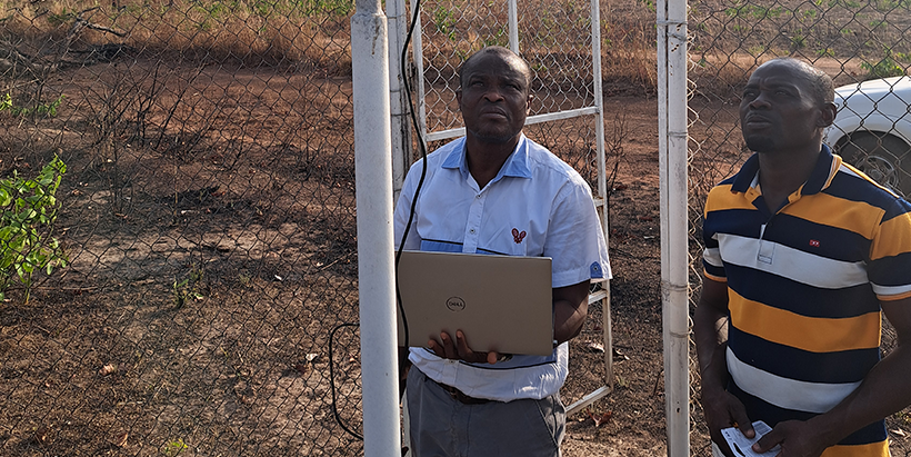
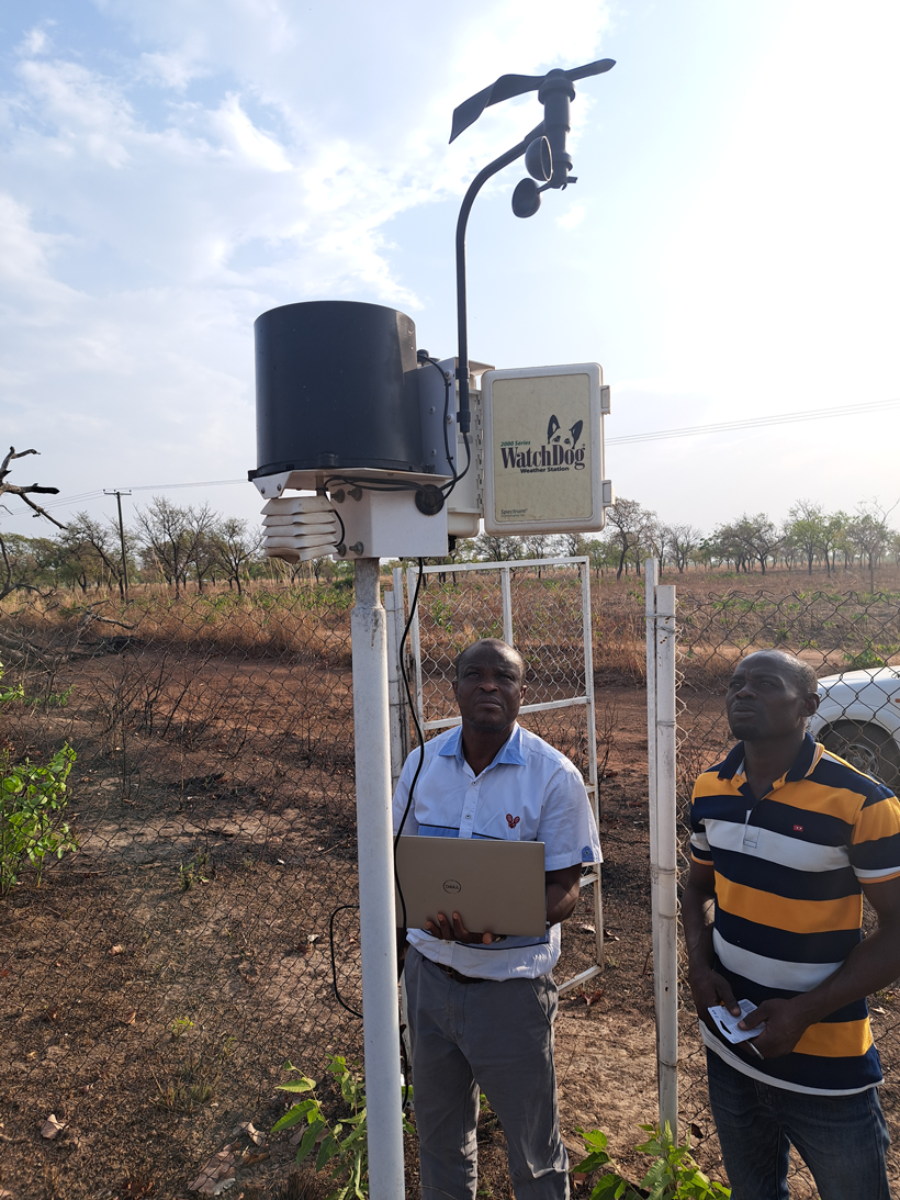
IITA staff on routine weather station maintenance in Northern Ghana. (Photo credit: IITA)
On World Meteorological Day, marked on 23 March, the world is asked to reflect on the importance of weather observation. This year’s theme, ‘Observing today, protecting tomorrow,’ could be read as an abstract aspiration. However, at the International Institute of Tropical Agriculture (IITA), it is a working description of what scientists do every day.
The weather in sub-Saharan Africa no longer follows the patterns farmers once relied on. Rain comes late, skips entirely, or arrives all at once. Temperatures shift in ways that favor new pests and ruin familiar harvests. Farming through that kind of uncertainty demands accurate, local, and timely information, and for most smallholder farmers across the region, that information is hard to find. As farming decisions are highly localized, generalized or broad recommendations can even be counterproductive.
To solve the challenge, IITA is set to contribute through its Digital Climate Advisory Services. This program links climate science, agronomic research, and digital technology to deliver practical guidance to farmers across diverse African landscapes.
Filling the gaps in the map
The most basic problem is that weather stations in sub-Saharan Africa are sparse and poorly distributed. Existing stations tend to sit near airports and government offices, not in the rural areas where agriculture drives livelihoods. Farmers making decisions about when to plant, when to apply fertilizer, or when a dry spell is likely to break have been left, largely, to read the sky themselves.
To enhance access to climate and weather information services, IITA operates 50 automated weather observation networks across Africa, placed at the farm level where IITA’s crop research programs work. The stations measure temperature, rainfall, humidity, and solar radiation continuously and are regularly maintained to remain accurate as conditions become more variable.
The data does more than fill gaps on a map; it provides the basis for validating satellite rainfall products, the gridded forecasts that many advisories and early warning systems depend on. A recent study by IITA scientists used the gauge network to assess which satellite-derived forecasts are reliable across different parts of Africa and in different seasons. When a farmer or an extension worker acts on a forecast, knowing that the forecast can be trusted is not a minor technical detail; it determines whether the advice is worth following.
Applying satellites to monitor trends of climate change
Ground stations answer questions about what is happening now. Understanding the direction of long-term change requires a different vantage point. IITA scientists use state-of-the-art gridded satellite precipitation estimates and advanced statistical methods to track rainfall and temperature trends across Africa’s agro-ecological zones, generating evidence on what is changing, where, and at what speed.
This work provides agricultural planners and policymakers with a factual foundation for decisions previously based on assumptions. It also points toward what is coming, supporting the design of adaptation strategies before the changes they respond to become irreversible.
From climate data to early warnings, AI-based decision-support systems
The most visible outputs of IITA’s climate science are the decision-support tools, which translate data into action for people who need to respond to risk at scale.
One is the Aflatoxin Early Warning System. Aflatoxin is produced by Aspergillus fungi that flourish in warm, humid conditions. It is invisible, colorless, and responsible for an estimated US$ 670 million in annual losses to Africa’s grain trade and a far heavier cost in public health borne by communities that consume contaminated food. Managing it has historically been reactive: test after the harvest, and deal with whatever is found.
Using satellite-derived climate data, historical contamination records, and machine learning, it forecasts aflatoxin risk zones in Eastern and Southern Africa before harvest. Policymakers can target testing resources. Traders can adjust storage and logistics. Extension workers can advise farmers on risk-reducing practices while there is still time to act.
“Our AI-driven system provides clear, actionable risk maps that empower farmers, traders, and policymakers to act proactively rather than reactively,” explained Dr Francis Muthoni, GIS and Remote Sensing Scientist.
A second tool targets soybean rust, a disease capable of destroying up to 80 percent of a crop, and is spreading into new areas as shifting wind patterns carry its spores farther and to different places. IITA and partners developed a publicly accessible early warning dashboard that generates predicted rust severity maps for seven countries in Eastern and Southern Africa. The maps draw on satellite biophysical data combined with disease scouting reports submitted by farmers and field agents via smartphone. Extension agencies can use them to direct resources; farmers can see whether their area is becoming a high-risk period while there is still time to act.
The thread running through all this work, from the gauge stations, the satellite analyses, to the AI risk forecasts, is the same thread that runs through this year’s WMD theme. Observation is not passive; when it is done well, and its outputs reach the people who need them, it is a form of protection.
IITA’s contribution to meteorology is not only in the scientific papers published. It is in the farmers who get a reliable forecast before they plant, the extension workers who open a rust risk map before they design their advisories, and the policymakers who see aflatoxin hotspots forming in time to inform mitigative measures. That chain from observation to decision is what the institute has been building, one instrument, and one model at a time.
Contributed by Gloriana Ndibalema, Francis Muthoni, Alabi Tunrayo, and John Choptiany

No Comments